
Pacific Crest Overland Route
- OTG Crew
- Jun 17, 2024
- 29 min read
Updated: Oct 9, 2024
Released in 2017, the 4-state Pacific Crest Overland Route became an instant classic and must-do for full time and experienced overlanders. The PCOR is one of the crown jewels of North America, highlight some of the most scenic and iconic sites along the West Coast.


PCOR Overview
The original development of the Pacific Crest Overland Route (PCOR) was spearheaded by a joint collaboration between Overland Journal (Expedition Portal) and Hema Maps. Chris Cordes, former editor of Overland Journal, was tasked with mapping and driving the route, and he published his adventure in the Summer 2017 volume of Overland Journal. Inspired by the long-distance backpacking route, the Pacific Crest Trail, the PCOR follows a similar track (open to vehicles, of course), largely paralleling the PCT.
The PCOR also incorporates an Alaska segment, which requires a ferry ride from Bellingham to Skagway, Alaska (or vice versa). Since its creation, the PCOR has become a favorite and must-do track for long-distance overlanders. Compared to many of the tracks you'll find on OTG, the PCOR includes some longer stretches of pavement. This enables travelers to cover greater distances in shorter periods while also encouraging them to get out of their vehicles, explore the surrounding towns, experience the local culture, and meet new people.
At OTG, we pride ourselves on providing the most detailed GPX files for our overland routes, and the Pacific Crest Overland Route is no exception. You'll find hundreds of discovery points and POIs within our PCOR GPX files. Additionally, we've made some small modifications to the original route, incorporating more dirt where we felt it would enhance the overland experience. Even with these small tweaks, the goal was always to retain the original character of the PCOR, which is now considered one of North America's classic overland tracks.
We've also added several alternative routes, offering travelers a variety of new experiences along the track. The PCOR route guides have been broken down into four distinct sections, all found on this page and separated by state: California, Oregon, Washington, and Alaska.
PCOR California Overview
Trip Length & Season
Adventure Rating: Dakar Trip Length: 1606 Miles miles, 2-4 weeks Season: The best season for the California segment varies depending on which portion you'll be traveling. For example, the southern most section from the Mexico border to Big Pine is best traveled in late October to early May in order to avoid extreme desert heat. While summer travel is possible along this segment, summer temps can exceed 110F along many portions of the route, and 120F in Death Valley. Most of the route north of Death Valley can be traveled from mid-June to October most years, but may vary depending on seasonal weather (snow). Higher elevation sections (Warners Mountains and Mt Patterson) may see a shorter window of when the trail is open. Check snow levels before heading out (we recommend Gaia GPS' NOAA Snowdepth layer).
Digital Maps & GPX Files
Technical Ratings & Terrain
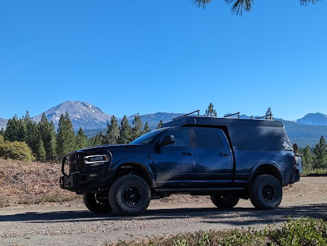
Recommended Vehicle / Moto / Adventure Vans
Fuel, Provisions, and Recommended Gear
Alternative Routes
Camping Recommendations
Discovery Points
Land Managers & Other Resources
Permits & Papers
California Segment Overview
At OTG, we provide ourselves on creating the most detailed and engaging backcountry adventures available. We've taken the liberty to optimize large portions of the California segment to incorporate more dirt (where we felt appropriate), and a number of alternative tracks (adding way more dirt and allowing a wide spectrum of vehicles to travel the PCOR, and to avoid the Dixie Fire that burnt large portions of the original route in 2021. We think you'll find the latest version of the PCOR California Segment will create a lifetime of memories. The terrain, geography, and ecological zones of the California segment of the PCOR are by far the most varied. Ranging from the desert lowlands of Southern California, which commonly reach 110°F in the summer months, to the snow-capped peaks of the Sierra and Cascades, travelers will be amazed by the diversity of scenery that the great state of California offers.
We begin our adventure at the Mexico border, adjacent to the largest dune field in North America (the vast majority of which is south of the border). The track starts in the Sonoran Desert, midway between Mexicali and Yuma. The desert section is dominated by wide open plains interrupted by rugged mountain ranges. You'll find some of the rockiest terrain on these desert tracks, especially through Old Dale Road (in the Joshua Tree vicinity), Mojave National Preserve, and Lippencott Pass in Death Valley. Highlights of the deserts include Salton Sea and Slab City, Old Dale Road, Mojave Road and the Cinder Cone Fields, and, of course, Death Valley.
One of the biggest challenges with the California segment is piecing together the mountainous sections of the north, which may not open until summer, with the desert sections in the south, where daily temperatures regularly exceed 100°F during the summer months and can exceed 120°F in Death Valley. Traveling from north to south may be recommended if one can time it right to make it through the high mountain passes and down to the desert in October, when temperatures begin to cool off, especially at night.
From Death Valley heading north, the track alternates between the high desert and the Basin Ranges that sit just a few miles east of the Sierra Nevada. The views of the eastern Sierra along this portion of the PCOR are second to none. Highlights along the central California segment include the Owens and Walker Rivers, Mono Lake, the Sierra Crest, Bodie Ghost Town, and the highest elevation section of the PCOR: Mt. Patterson and the Sweetwater Range.
While it's easy to push the accelerator to the floor and blast through the PCOR, that would be missing the point, and this portion of the track through the high desert and Basin Ranges exemplifies this. Go and check out those discovery points that are just a mile off the main track, like Willy's Hot Springs and the many other hot springs within a mile of Willy's. Get out of the vehicle and marvel at the majestic tufas that rise up from the prehistoric alkaline waters of Mono Lake, drive to one of the highest locations on the West Coast, Mt. Patterson (elevation 11,654 feet). And while driving through the high elevations of the White Mountains, you'll have the opportunity to visit some of the oldest living things on the planet: the Bristlecone Pines, which can reach nearly 5,000 years old. We still haven't mentioned Bodie— with nearly 200 buildings still standing, this is one of the best-preserved ghost towns in the United States.
The PCOR makes its way into the mighty Sierra just south of Lake Tahoe, by way of Monitor Pass and Markleeville. Markleeville marks the first of many quaint villages, hamlets, and towns that can be found in the Sierra and Cascades. While most overlanders are accustomed to backcountry travel that often bypasses such places, we encourage all of our members to pay homage to these special places and the people who live there. Many of these towns are discovery points along the PCOR, and they're typically filled with vibrant people and local culture. Chances are, if you do stop, you'll have a story or two to share with your friends when you finally make it back home!
The leg of the track around Lake Tahoe is dominated by pavement, but the views of the Tahoe Basin are always awe-inspiring. For those looking to hit more dirt, check out the Tahoe Reroute in the alternative tracks, which passes through the mountains to the east and features plenty of dirt and a few moderate jeep tracks as well. Highlights along this section include Emerald Bay and historic Truckee. As you leave the pavement behind and drive deeper into Tahoe National Forest, dozens of alpine lakes begin to appear, the biggest and most popular being Bowman Lake. If you can visit during the week, chances are you'll be able to snag one of its scenic lakeside campsites. Henness Pass acts as an unofficial dividing line between the central Sierra and northern Sierra—where the Lost Sierra begins.
While not as rugged as the high peaks to the south, the Lost Sierra is an outdoorsperson's wonderland. It is filled with dozens of alpine lakes, hundreds of miles of hiking and biking trails, and the crown jewel of the northern Sierra: the Sierra Buttes, which loom over Downieville and the Lakes Basin regions. Highlights along this segment include Downieville, Sierra Buttes Lookout (some of the best views along the CA segment!), Gold Lake, Frazier Falls, and Plumas-Eureka State Park. While the discovery of gold in 1849 brought much attention to the central Sierra gold fields, the Lost Sierra is steeped in gold fever as well. Traveling through these mountains and hills, you’ll find telltale signs of a mining past (and ecological pillaging and disaster) everywhere. The numerous renovated buildings and museum at Plumas-Eureka State Park are the perfect place to immerse yourself in the region's mining history.
Some of the best dispersed campsites along the California segment are found in the Lost Sierra. Places like Gold Lake (we recommend the 4x4 camp) and Lots-o-Lakes Road have incredible sites, but it can get busy during the summer, especially on weekends. As you travel north from Gold Lake, you'll pass through a number of mountain towns like Graeagle, Portola, and Quincy, each with its own unique vibe and character. As you make your way around Lake Davis, long gone are the crowds of Lake Tahoe and the Lost Sierra. You're now entering the southernmost reaches of the Cascade Volcanic Arc.
From Lake Almanor, the track cuts westward, following portions of the Lassen Backcountry Discovery Trail to avoid the original route that passed through the heart of the Dixie Fire. Highlights along this section include Lassen Peak, Black Rock, Brokeoff Meadows (camp here if you can!), and Chaos Crags. For those who want the full Lassen experience, we recommend taking the alternative route through Lassen Volcanic National Park. The short hike along the Bumpass Hell boardwalk is a must-do if you make the visit. Continuing northward, remnants of the area's volcanic past are everywhere, the first being the giant plug dome of Black Rock. For the best views of the southern Cascades, you'll need to make the 10-mile drive to the top of Burney Mountain, which features excellent views of Lassen Peak and Mt. Shasta.
Not far from Burney Mountain sits the idyllic mountain town of Burney, surrounded on all sides by mountains cloaked in the deep green of pine and fir. Not far from town lies one of the most popular destinations in northeastern California: Burney Falls (fee required). A large fern-lined cascade tumbles nearly 130 feet down a cliff into a shaded pool. Leaving Burney Falls behind, you're now entering the Modoc Plateau, which represents the eastern boundaries of the Cascade Volcanic Arc. The land tends to be flatter, with low elevation hills, most of which are ancient cinder cones. The track climbs up to Medicine Lake, which is actually the caldera of the Medicine Lake volcano, one of the largest shield volcanoes on earth!
Down the mountain from Medicine Lake, you'll find Lava Beds National Monument, which features over a dozen lava tubes (caves) that are open to the public. Many of the caves, like Mushpot Cave, extend several hundred yards underground. From Lava Beds, the track heads north past the remnants of Lower Klamath Lake and to the Oregon border, where we hope you'll continue your adventure along the Pacific Crest Overland Route.
PCOR Oregon Overview
Trip Length & Season
Adventure Rating: Baja Trip Length: 545 miles, 5-12 days days Season: June to October. Depending on seasonal snowfall, trails may be open earlier or later than these months. Bypassing the high elevation section around Crater Lake is likely to extend the seasonal window to May and November.
Digital Maps & GPX Files
Technical Ratings & Terrain
Recommended Vehicle / Moto / Adventure Vans
Fuel, Provisions, and Recommended Gear
Alternative Routes
Camping Recommendations
Discovery Points
Land Managers & Other Resources
Permits & Papers
Oregon Segment Overview
A cool wind whistled through the pines around us, and I took a deep breath, filling my lungs with crisp mountain air. We had only left the hustle and bustle of Portland’s streets that morning, but the city’s traffic jams and red lights already seemed a world away. Their constant drone had been replaced by the quiet tunes of nature’s melody, and I tried to appreciate its subtleties while my eyes surveyed the vista before me. Far below, a sea of clouds stretched out toward the horizon, rolling over the forest floor and breaking against the rising terrain like waves on a distant shore. Here and there, splashes of brilliant gold trees dotted the landscape; rising from the center of it all was Mount Hood, its snow-capped peak piercing high into the blue sky above. I leaned back on the grass beside the road and sighed in admiration. This was the Pacific Northwest I had been dreaming of—this was Oregon. -Chris Cordes formerly of Overland Journal The Oregon segment of the PCOR is a 545-mile long journey that cuts through the heart of the central Cascades. Beginning just south of the Klamath River, the track follows a south to north path (but can be driven in either direction) eventually meeting the Washington segment at the Columbia River Gorge, a few miles from the city of Hood River, OR. As you venture northward, High Cascades greet you with its majestic peaks. Landmarks such as Mount McLaughlin, Mount Washington, Mount Jefferson, and the iconic Mount Hood dominate the skyline, embodying Oregon’s wild spirit.
The PCOR offers more than breathtaking scenery. Like the California and Washington segments, the Oregon segment of the PCOR is a mixture of dirt and pavement. Many of the paved roads offer travelers the opportunity to get out and explore. Quaint towns, farms, and hamlets along the route welcome you to immerse yourself in local culture and cuisine.
While some may argue that the Pacific Northwest extends down to the redwood coast of Northern California, most folks, and especially native Oregonians, will tell you their state is the gateway to the Pacific Northwest. From towering mountains and secluded coastlines to lush forests, volcanic craters, and high desert plains, you can experience this variety often within a single day’s drive. Culinary enthusiasts will find delight in the excellent restaurants scattered along the way. Additionally, the vibrant arts scene and unique culture offer ample exploration opportunities.
Nature lovers will be captivated by Oregon’s lush forests, which cover nearly half the state, primarily west of the Cascades. These Douglas fir-dominated forests are home to a rich array of plant and animal life. As you cross into California, it’s evident you’re in the rain shadow of the High Cascades. The hill region east of Upper Klamath Lake feels more like the drier, high desert regions around Bend or the central Sierra Nevada. The track weaves its way through the forest on a series of mellow dirt roads where you may encounter deer, elk, or black bear, and eventually crosses the pavement of Highway 97.
As the road ascends into the heart of the Cascades, you’ll catch glimpses of valleys and meadows framed by towering peaks. The air grows crisper, and the scent of pine fills the air, offering a true wilderness experience and a chance to disconnect from daily life and reconnect with nature.
For the next 400 miles, the track weaves through and around the Cascade Range. The track climbs higher until eventually reaching Rim Road and Crater Lake National Park. During years of heavy snowfall, it’s not uncommon for West Rim Road to remain closed through mid-July. At 1,943 feet, Crater Lake lives within a giant volcanic caldera. It’s been like this for millennia, replenished solely by rain and snowmelt. Its mesmerizing sapphire waters against dramatic cliff backgrounds draw visitors from around the world. As you drive around Rim Road, be sure to keep a watchful eye for the lake's various landmarks like Wizard Island, Mt. Scott, and Phantom Ship.
Continuing north, the PCOR winds through charming towns like Fort Klamath and Oakridge, inviting you to enjoy local cuisine, explore unique shops, and soak in small-town charm. The ever-changing panorama of Cascade peaks provides a breathtaking backdrop throughout the journey. You’ll notice the trees are taller, and the forest darker, thanks to Douglas Fir and other conifers, which can grow to massive sizes and heights that nearly rival the coast redwoods to the south. Oregonians flock to the forests in the Cascades during the summer months, so expect quite a few folks along the track once you get north of Oakridge and all the way to Hood River. That doesn’t mean you won’t find solitude along the track, but the crowds definitely come out on the weekends. While most of the roads are wide and relatively well-kept, expect to hit some tighter sections with encroaching brush and low-hanging branches as you close in on the Columbia River.
The route eventually leads to Hood River, a town along the Columbia River known for its paddling, rock climbing, cycling, fishing, and camping opportunities. When the weather turns, find comfort in Hood River’s cozy coffee shops, restaurants, or breweries. Although Hood River marks the northern terminus of the Oregon PCOR, your adventure doesn’t have to end here, as the Washington segment of the PCOR awaits just across the mighty Columbia.
PCOR Washington Overview
Trip Length & Season
Adventure Rating: Baja Trip Length: 727 miles, 7-14 days Season: June to October. Depending on seasonal snowfall, trails may be open earlier or later than these months.
Digital Maps & GPX Files
Technical Ratings & Terrain
Recommended Vehicle / Moto / Adventure Vans
Fuel, Provisions, and Recommended Gear
Alternative Routes
Camping Recommendations
Discovery Points
Land Managers & Other Resources
Permits & Papers
Washington Segment Overview
Some journeys are about rediscovering the places we already know and seeing them in a new light. This was our goal with the Washington portion of the Pacific Crest Overland Route (PCOR)—to experience the unique beauty of its small towns and backroads, from the shores of Bellingham to the Oregon border.
-Chris Cordes formerly of Overland Journal Like the other segments of the Pacific Crest Overland Route, the Washington segment can be driven from north to south, or vice versa. If you plan to follow the various discovery points of the track, you'll find all of our segment route guides for the PCOR follow a south-to-north direction, traveling from the Mexico border to the Arctic Circle within Alaska. The Washington segment "begins" at the Columbia River Gorge and finds its terminus at the Bellingham Ferry Terminal, which acts as a connector to Skagway for travelers who wish to continue north onto the Alaska segment of the PCOR.
The Cascade Range acts as the guiding geological feature that shepherds the PCOR along its south-to-north journey. While the track does skirt eastward into Wenatchee Valley and the Okanogan Range, it is the Cascades that are by far the most dominant geological feature of the Washington segment of the PCOR. The southernmost portion of the route is dominated by the green forests that buttress the Columbia River Gorge and flank the mountain slopes of Mt. Adams. Visitors will find emerald highways of dirt and pavement, and all kinds of interesting features that tell of the Cascades' volcanic past and present. The massive Big Lava Bed (discovery point) is a perfect example of the volcanism that envelops this portion of the track.
As you leave Mt. Adams behind, Washington's most famous peak comes into view: Mount Rainier. The paved section through Mount Rainier National Park is filled with fantastic views of the snowcapped volcano, and waterfalls seem to be around every twist and turn. This leg of the journey is easily one of the most scenic sections of the Washington segment. The track continues eastward, and then northward, passing through quaint villages and historic towns like Cle Elum, Ellensburg, Cashmere, Chelan, and Winthrop. While the overland crowd in the States often likes to stick to the backcountry, any seasoned overlander who's traveled long distances internationally, or adventure bike riders, will tell you that going into town (whether that's a village, town, hamlet, or city) is one of the best ways to learn about the local culture, all the while making friends and hopefully a few memories along the way. We highly encourage folks to stop and explore these wonderful locations along their journey.
The final leg of the track travels from the much drier Okanogan Range and through the incredibly picturesque Northern Cascades. The Northern Cascades contain some of the most rugged mountains in the lower 48. Much like the section through Rainier National Park, the pavement through Northern Cascades National Park is filled with sublime views of the glacier-carved alpine landscape. If you're looking to explore the area on dirt, we recommend checking the alternative route to Slate Peak, which features some of the best views of the Northern Cascades.
Upon reaching the confluence of the Skagit and Cascade Rivers, you've nearly reached the outskirts of Bellingham. Bellingham is a fast-growing college town (Western Washington University) that has solidified itself as one of the premier outdoor recreation destinations in the Pacific Northwest, and people come from across the country to ride its famously technical mountain bike trails. Downtown has the energy and quirkiness that you'd expect from a college town in the Pacific Northwest, and talking to the locals, it's hard to track down someone who has anything bad to say about the place. The track ends at the Bellingham Ferry Terminal, which acts as the connector to Skagway, Alaska.
PCOR Alaska Overview
Trip Length & Season
Adventure Rating: Dakar Trip Length: 1,605 Miles miles (to reach Deadhorse, doesn't include mileage and time to return), 4-8 days (to reach Deadhorse) Season: The main route to Deadhorse is open year round, but most folks travel tend to visit in August or September. Just remember, the earlier you go in the season (late spring, early summer), the more mosquitoes you will encounter.
Digital Maps & GPX Files
Technical Ratings & Terrain
Recommended Vehicle / Moto / Adventure Vans
Fuel, Provisions, and Recommended Gear
Alternative Routes
Camping Recommendations
Discovery Points
Land Managers & Other Resources
Permits & Papers
Alaska Segment Overview
Alaska, the final frontier. At 665,000 square miles, Alaska has more land mass than Texas, California, and Montana combined! With a population of just over 700,000 people, this leaves vast swaths of the state virtually unspoiled. Despite its massive size, the California segment ekes out the length of the Alaska segment by a single mile (1,606 vs. 1,605 miles), but don't forget, once you make it to the Arctic Sea, you'll need to drive back south, effectively doubling your distance. Another note about the Alaska segment is that it primarily consists of pavement. While there are a number of side adventures that follow dirt roads deep into the Alaska wilderness, the vast majority of the main track is on pavement. The longest stretch of gravel is along the Dalton Highway (about 75% of the Dalton remains unpaved). For those looking to maximize gravel travel, the Denali Highway (alternative route) also features long stretches of gravel, along with the other alternative routes.
For those who reach Alaska, your adventure begins at the port of Skagway. Skagway was once the gateway to the Klondike gold rush, and the remnants of the region's mining past, including Skagway's well-preserved gold rush architecture, can be spotted throughout town and the surrounding area. For those looking to delve into the local culture and history, we recommend visiting the Klondike Gold Rush National Historical Park Visitor Center, historic downtown Skagway, and the Skagway Museum.
From Skagway, the Klondike Highway climbs abruptly into the mountains, summiting at White Pass. The majestic peaks of the Sawtooth Range rise up from both sides of the highway, presenting a stunning introduction to the Alaskan wilderness. The track continues northward, eventually passing into Yukon Territory. Don't forget, you'll need your passport handy in order to cross into Canada. Whitehorse is perhaps the most famous of the Klondike gold rush boomtowns and is considered the gateway to the vast wilderness of the Yukon. Whitehorse is a vibrant community steeped in its past with a deep connection to the natural world. Sitting along the banks of the mighty Yukon River, walking the streets of downtown, and visiting the MacBride Museum of Yukon History should be a must for every traveler passing through Whitehorse.
While the stretch through the Yukon is relatively brief (350 miles, can be easily driven in a day), the St. Elias Mountains and Kluane National Park create a dramatic backdrop for much of the journey. The well-known outpost of Haines is the only real place you'll find a decent amount of amenities as you travel through the Yukon. The massive wilderness and numerous snowcapped mountain ranges create a maze of rivers across the Yukon and Alaskan wilderness. It's no wonder the salmon runs are so plentiful, leaving fishermen and grizzlies alike plenty for the take.
As you cross back into Alaska and make your way towards the charming towns of Palmer and Wasilla, the Wrangell Mountains arise dramatically above the floodplains of the Copper River. The Copper River acts as a divider, separating the Chugach Mountains to the west. The Chugach Range features your first opportunity to get up close with a glacier. Leaving the highway, one can follow Island Road to a small dirt lot, just beyond the terminus of the spectacular Matanuska Glacier. Look closely, and you may be able to find the hiking trail that leads to the base of the glacier.
Both Palmer and Wasilla are worth visiting, but Palmer definitely has a more charming downtown with its historic area that's dotted with unique shops and restaurants. As you leave the Matanuska Valley and head north, the Alaska Range thrusts upwards into the clouds. The Alaska Range is home to North America's highest peak, Mt. Denali (elev. 20,308'). Traveling north, there are numerous viewpoints and pullouts to capture the majestic Mt. Denali. At the rural outpost of Cantwell, the route bisects the Alaska Range as it heads towards the city of Fairbanks.
At this point, you've traveled over 1,100 miles to reach Fairbanks, and while that may seem like an accomplishment, you've still got another 500+ miles to reach Deadhorse. Fairbanks is a sizable city (by Alaska standards) with plenty of amenities. Keep in mind, the final stretch from Fairbanks to Deadhorse is by far the most remote, with amenities and fuel stations few and far between. From Fairbanks, you'll travel through the lower elevation Brooks Range, and into the taiga plains that the Arctic is famous for. You know you're getting close to Deadhorse when you reach the famous Arctic Circle sign. From here, it's less than 300 miles to reach Deadhorse.
After crossing the Yukon once again, Coldfoot provides your last opportunity for fuel before reaching Deadhorse. Leaving the Brooks Range, the Sag River begins to take shape, growing in size as it nears its terminus at Prudhoe Bay. The end of the track is in Deadhorse. To reach Prudhoe Bay and the Arctic Sea, you must make travel arrangements with the local shuttle service in town—an absolute must for anyone who's made it this far!
Terms of Use: Should you decide to travel a route that is published on Overlandtrailguides.com, you do so at your own risk. Always take the appropriate precautions when planning and traveling, including checking the current local weather, permit requirements, trail/road conditions, and land/road closures. While traveling, obey all public and private land use restrictions and rules, and carry the appropriate safety, recovery, and navigational equipment. The information found on this site is simply a planning resource to be used as a point of inspiration in conjunction with your own due-diligence. In spite of the fact that this route, associated GPS track (GPX and maps), and all route guidelines were prepared under diligent research by OverlandTrailGuides.com, the route accuracy and current conditions of roads and trails cannot be guaranteed.