
Mendocino Grand Circuit
- OTG Crew
- May 24, 2020
- 4 min read
Updated: Mar 31
Just a few shorts hours from Sacramento and the San Francisco Bay Area, the Mendocino National Forest is beloved by those who know its splendor. The crowds tend to flock to places like Lake Tahoe, the high Sierra, and Big Sur, leaving the Mendocino splendidly wild-- just the way we like it!
Route Overview
Trip Length & Season
Adventure Rating: Epic
Trip Length: 301 miles, 4-7 days
Season: Late May - November (season may open earlier/later depending on snow levels. Always check on snow levels if you plan to visit in mid-spring or mid-fall).
Digital Maps & GPX Files
Technical Ratings & Terrain
Recommended Vehicle / Moto / Adventure Vans
Fuel, Provisions, and Recommended Gear
Alternative Routes
Camping Recommendations
Discovery Points
Land Managers & Other Resources
Permits & Papers
Route Details
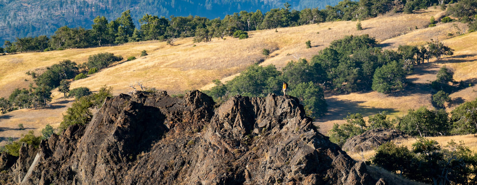
The Mendocino National Forest is a hidden gem of a forest. You'd think with its proximity to the San Francisco Bay Area and Sacramento, that people would be flocking to this forest. But hey, that's fine by us, as one of our favorite things about the Mendocino, is how easy to escape the crowds and the trappings of modern civilization.
While the Mendocino Backcountry Discovery Trail is a great introduction to the forest, it really doesn't do justice in terms of exposing the visitor to some of its more scenic areas. The Mendocino Grand Circuit was intentionally designed to take advantage of the plentiful natural and recreation opportunities within the forest. For the most part, the route follows the M-road system in the forest, which consists of primarily wide and graded dirt forest service roads that can be driven a a 2 wheel drive vehicle in most instances. We still recommend a truck or SUV with 4x4, but for the majority of the route, something like a stock RAV4 or Subaru will manage just fine.
The route begins in the east side of the forest on FH7, but ends on the west side of the forest, in the Eel River Canyon and Potter Valley. Over the course of 300 miles, you'll traverse through mixed conifer forests, oak dotted rolling grasslands, river canyons, and some amazing lookout points-- Hull Mountain and Anthony Peak being our two favorites. From the top of Anthony Peak, on a clear day ou can see Mt Lassen to the east, and the Pacific Ocean to the west. The forest is filled with hundreds of miles of sided roads and some more technical OHV trails. If exploring the backwoods of the backcountry is your thing, the Mendocino has got you covered in spades! The forest also offers ample opportunity for boating, swimming, hiking, bird watching, target shooting, and OHV riding.
Gallery


Terms of Use: Should you decide to travel a route that is published on Overlandtrailguides.com, you do so at your own risk. Always take the appropriate precautions when planning and traveling, including checking the current local weather, permit requirements, trail/road conditions, and land/road closures. While traveling, obey all public and private land use restrictions and rules, and carry the appropriate safety, recovery, and navigational equipment. The information found on this site is simply a planning resource to be used as a point of inspiration in conjunction with your own due-diligence. In spite of the fact that this route, associated GPS track (GPX and maps), and all route guidelines were prepared under diligent research by Overland Trail Guides, the route accuracy and current conditions of roads and trails cannot be guaranteed.
Commenti